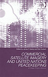
Commercial Satellite Imagery and United Nations Peacekeeping [Keeley/Huebert, 2004] (hardcover)
This book examines the possibilities for the use of satellite imagery in support of UN peacekeeping operations, and also to protect the national security of Canada. Experts in the field discuss the needs of peacekeeping operations, the requirements for the use of such imagery and the capabilities for providing it. The organizational, political and other issues which arise from the use of such imagery are also given careful consideration.
Table of Contents
Ch. 1: International Law Governing the Acquisition and Dissemination of Satellite Imagery
Ch. 2: Availability and Potential Use of Low Spatial Resolution
Ch. 3: Commercial Satellite Imagery
Ch. 4: Trends in Commercial Satellite Imaging
Ch. 5: Development of Geospatial Technology
Ch. 6: Financial Consideration in the Acquistion of High Resolution
Ch. 7: The use of Commercial Satellite Imagery
Ch. 8: Organizing the United Nations
Ch. 9: Peacekeeping and Intelligence
Ch. 10: Commercial Satellite Imagery
Ch. 11: Commercial Satellite Imagery and Canadian National Security
Ch. 12: Two Steps Back
Ch. 13: Access Control of Remote Sensing
Ch. 14: Blue Eyes: Surveillance Satellites
Ch. 15: Canada and Commercial Satellite Imagery